SEASONAL INFO
The Iron County Road Commission announces:
- EFFECTIVE 7:30 a.m., TUESDAY, NOVEMBER 25, 2025 , Division Street from M73 to 900 feet Easterly HAS BEEN CLOSED for the winter to ALL traffic.
- EFFECTIVE 6:00 a.m., WEDNESDAY, MAY 14, 2025, ALL spring road restrictions have been LIFTED on all roads in Iron County.
The spring road restriction period usually lasts around 63 days. The road restriction period has started as early as January 31 and has ended as late as June 1.


Click the MDOT MiDrive Map for trunkline road conditions and closures and more.
MDOT Winter Level of Service Definitions:
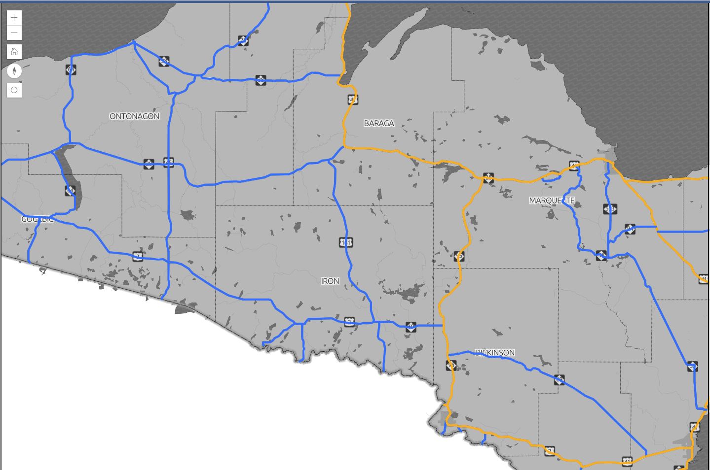
Priority #1- Orange Route
Provide maintenance service as appropriate under prevailing weather conditions, with a goal of providing a pavement surface over its entire width *generally bare of ice and snow.* This work may be accomplished using overtime as necessary.
Clearing the pavement bare of ice and snow over its entire width will be a continuous process during and after the snow event using overtime as necessary.
Priority #2- Blue Route
Provide maintenance service as appropriate under prevailing weather conditions, with a goal of providing a pavement surface *generally bare of ice and snow* wide enough for one-wheel track in each direction. This work may be accomplished using overtime as necessary during a winter storm event.
Clearing the pavement bare of ice and snow over its entire width will be accomplished as soon
as reasonably possible after the winter storm vent, without
working overtime.
A *generally bare of ice and snow* pavement is defined as a travel lane surface that is free from drifts, snow ridges, and as much ice and snow pack as practical.


Winter Safety 101:
Always scrape off your windshield before heading out!
Have you checked your tires lately? Give ’em a look before the snow falls-bald tires can be dangerous on the roads.
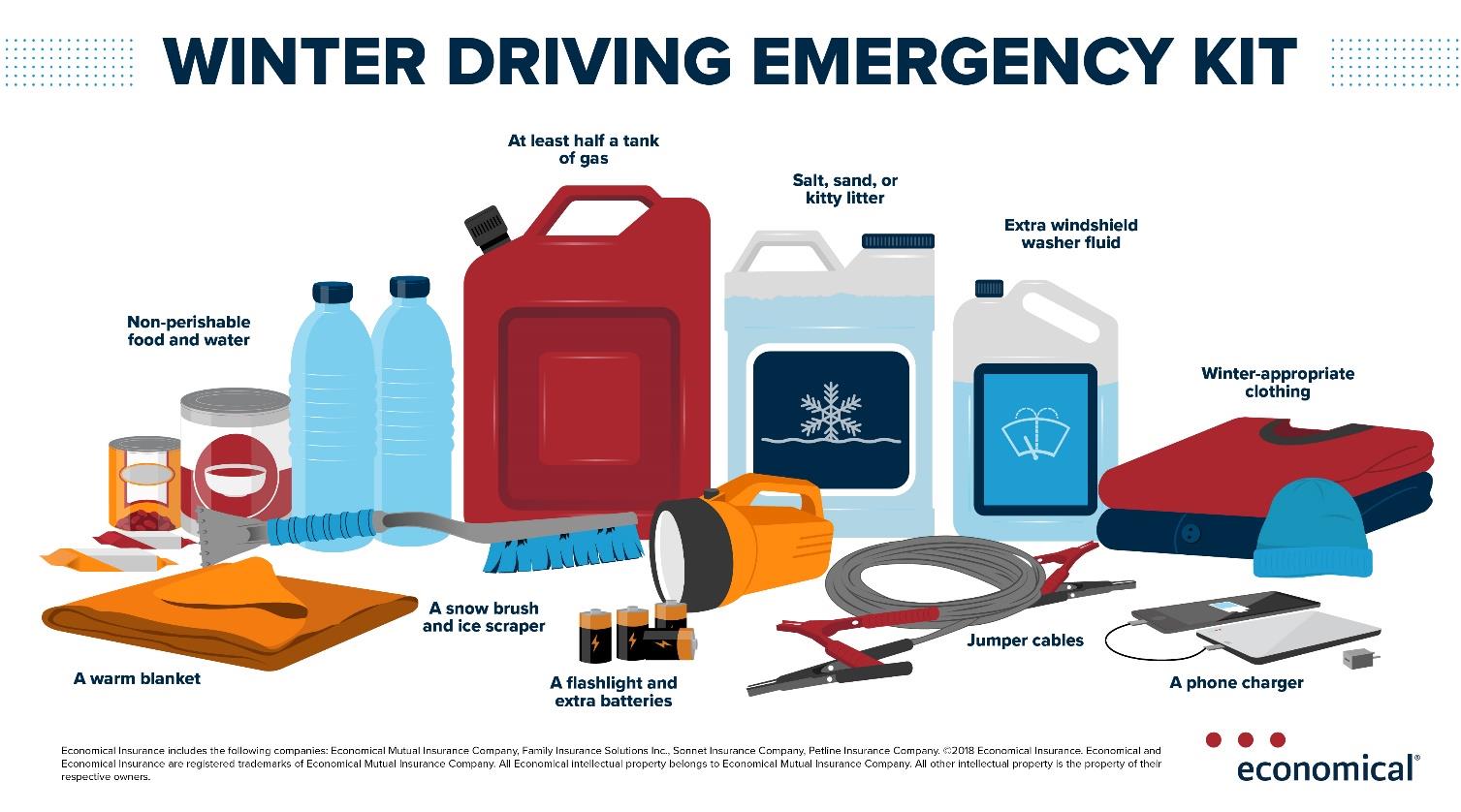
Snow’s coming-are you ready? Prep your car with an emergency preparedness kit!
Did you know…
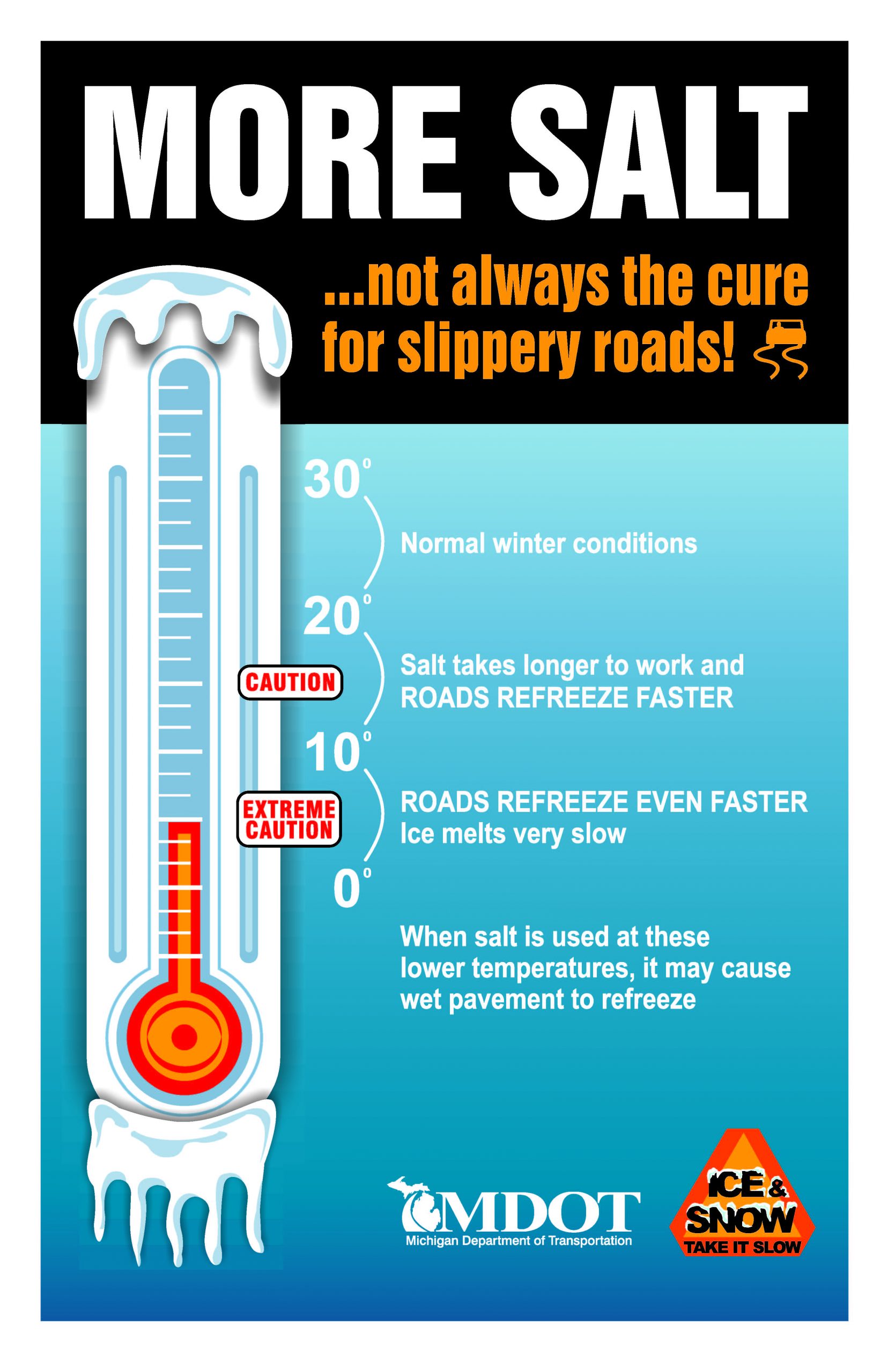
Salt isn’t always the cure for slippery roads. When the temperature drops to below 10 degrees, salt treated roads refreeze quickly, making them even more icy and slippery. In those conditions, it’s safer to NOT use salt, but sand instead.
During a typical winter season, the Iron County Road Commission uses 15,875 tons of sand and 6,376 tons of road salt on average. The use of these materials is a balancing act that we face every winter. Protecting human life is our top concern.

